
Big Brother satellite planned to launch: capable of zooming in on anyone
[ad_1]
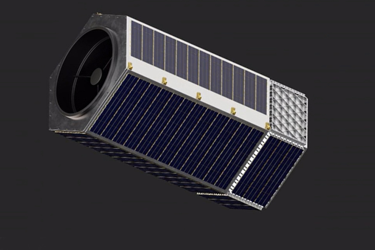
Privacy experts are sounding the alarm about a new satellite that can track your every move, slated for launch in 2025. The satellite, built by start-up company Albedo, is so high-quality it can zoom in on people or license plates from space, the Daily Mail reports, raising fears among experts that it will create a “big brother is always watching you” scenario.
Albedo says the satellite will not have facial recognition software, but does not say it will refrain from taking images of people or protecting their privacy.
Albedo signed two separate million-dollar contracts with the U.S. Air Force and the National Aerospace Intelligence Center to help the government track potential threats to U.S. national security.
Last month, the company raised $35 million to commercialize its Very Low Earth Orbit (VLEO) satellite, adding to the $48 million it raised in September 2022.
Albedo co-founder Topher Haddad said he and his team hope to eventually have a fleet of 24 spacecraft.
“This is a giant camera in the sky that any government can use at any time without our knowledge,” Jennifer Lynch, general counsel of the Electronic Frontier Foundation, told the New York Times. “We should definitely be concerned.”
“This brings us one step closer to a world that is being watched by Big Brother,” added Jonathan K. McDowell, an astrophysicist at Harvard.
Albedo was founded in 2020 and began building its satellites the following year using close-up technology made possible by the Trump administration’s moves to relax government regulations allowing the use of civilian satellites in 2018.
Then-President Donald Trump updated the U.S. standard practices for dealing with orbital debris and developed new guidelines for satellite design and operation.
Under previous National Oceanic and Atmospheric Administration (NOAA) rules, it was illegal to build a satellite that could see less than 30 centimeters – at that distance it could only identify cars and houses, but not individual people.
But under Trump’s new directive, satellites would be allowed to track objects in space that are about 10 centimeters in size, which would improve the Air Force’s ability to catalog objects.
Most satellites are in orbit between 160 km and 2,000 km from Earth, and all of them can currently detect objects with a diameter of about 30 centimeters, writes the Daily Mail.
At this distance, satellites can only see things like street signs and aircraft tail numbers, but Albedo aims to get even closer.
The company’s satellites will create images just 10 centimeters in diameter using telescope mirrors polished to 1/1000 the size of a human hair.
The smaller centimeter size of the images means the images won’t be as pixelated, allowing those using the satellite to see objects, places and people with greater accuracy.
The satellites will orbit up to 100 miles from the Earth’s surface and could be used for life-saving measures, such as helping authorities map disaster zones.
Albedo satellites use an intuitive interface to monitor and track trends in existing imagery, and their cloud-native delivery pipeline allows information to be collected in less than an hour.
Haddad raised concerns that the satellites would violate people’s right to privacy in a public forum, writing that the company is “acutely aware of the privacy implications and potential for abuse” and expects this to be an “ongoing, evolving issue over time.”
He confirmed that the satellite’s 10cm resolution would allow people to be identified, but said the company would only approve customers on a case-by-case basis and would create “robust internal tools to find bad actors, as well as obvious measures to add punitive provisions to our terms and conditions.” .
In March 2022, Albedo received a $1.25 million contract from the U.S. Air Force for a second phase of development to determine whether the satellites could identify missile launchers on warships, equipment on electronics vans, and fairings on fighter jets.
The company also said its satellites can help governments “monitor hotspots,” resolve uncertainty and mobilize quickly.
In April 2023, Albedo signed another $1.25 million contract with the National Air and Space Intelligence Center, which assesses foreign threats, to obtain night-time thermal infrared imaging, combining visible and thermal imaging to determine whether an object is active or passive. is it moving or stationary?
“We are committed to enhancing the Air and Space Force’s ability to understand its effectiveness in meeting our missions and to apply our capabilities in orbit,” said Joseph Rouge, U.S. Space Force deputy director for intelligence, surveillance and reconnaissance.
“Night-time thermal infrared imaging can help our intelligence analysts, warfighters, decision makers and field operators address complex emerging threats day and night,” he added.
Then, in December, the company signed a two-and-a-half-year contract with the National Reconnaissance Office to use the satellite’s thermal infrared data to provide “geospatial intelligence for climate, food security and the environment through daily surface temperature data and analytics.”
Haddad argued that the technology would help curb climate change by showing which regions are being hit the hardest, and said it “could simultaneously be used to support our national defense mission and mitigate our global environmental/climate crisis.”
The latter consideration raises concerns among experts, who say that while such satellites may be useful in some scenarios, the potential for overuse and human rights violations is a growing concern.
John Pike, director of Global Security.org told the New York Times that Albedo downplays the potential consequences of creating a satellite that can distinguish between human forms. “You’ll start to see people,” he told the publication. “You’ll see more than dots.”
In the past, private satellites have proven useful for scientific research and commercial use, and have helped governments with issues such as “tracking global oil reserves, measuring deforestation in the Amazon, and identifying illegal fishing boats,” according to the Electronic Frontier Foundation (EFF).
The EFF said more detailed satellites could violate human rights: “The same technology that reveals human rights violations can also be used to perpetuate them.”
Experts fear this could mean privacy will become a thing of the past, with government agencies able to view anyone, anytime, anywhere without their knowledge. “This is a giant camera in the sky that any government can use at any time without our knowledge,” Jennifer Lynch, general counsel for the EFF, told the New York Times, adding: “We should definitely be concerned.”
[ad_2]
Source link


