
Roman Vilfand explained the reasons for the weather apocalypse in the south of the Russian Federation
[ad_1]
According to the scientific director of the Hydrometeorological Center of Russia, Roman Vilfand, meteorologists warned Crimeans about the hurricane 2-3 days in advance, and thanks to this, the risks were minimized. He explained whether the current extreme weather events are related to global warming, and what to expect from the weather in the near future.
“Over the past 25 years, the number of dangerous weather phenomena in Russia has doubled,” says Roman Vilfand. – Similar calculations are carried out by almost all national meteorological services. The World Meteorological Association has released information that over the past 40-50 years the number of hazardous weather events has increased fivefold worldwide. The fact that extreme weather events have become more frequent can be considered a consequence of global warming. This can be explained by the fact that the energy of air masses in the lower troposphere increases significantly due to rising temperatures. Global warming is a trend, the average temperature on the globe. It is clear that each point has its own characteristics…
Roshydrometcenter predicted these extreme weather events in the southern regions of the country 2-3 days in advance. Hurricane winds were predicted by the territorial structures of the Roshydrometcenter both in the Crimea and in the North Caucasus branches… Still, it is possible to predict every such event. In winter – in 2-3 days, in summer – with much less advance, because in summer more complex processes associated with convection (a type of heat exchange (heat transfer)) occur, here we are talking about hours.
– What exactly causes the current weather apocalypse?
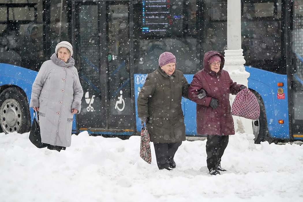
– We are actually talking about one baric formation with low pressure – a cyclone. A cyclone is an area of low pressure, and it is a fairly uniform area. But the weather and synoptic conditions in different parts of this cyclone are significantly different. In a cyclone, air moves counterclockwise. And this means that in the cyclone that emerged from the Mediterranean Sea, through the Balkans, Ukraine, the Central Black Earth Region to the center of European Russia, air masses moved from the south along its eastern periphery. Therefore, they are warm and saturated with moisture. This caused the heaviest snowfall, which happens once every 40 years. In Moscow, 16-20 mm fell overnight. This is a huge amount for winter! Since the air is warm, precipitation also fell in the form of sleet and freezing rain. Tonight it turned out that in the Tambov, Kursk, Voronezh, Bryansk, Ryazan and Moscow regions, snowflakes fell from a height of 3-4 km, melted, turned into raindrops, and then, falling below, where the temperature was negative, they were covered with an ice crust. This is how freezing rain forms. When freezing rain hits the underlying surface, the crust breaks, the water instantly freezes, and conditions are created for extreme sliding. In meteorology, this is called black ice – a very dangerous phenomenon.
This is what concerns the eastern periphery of the cyclone. And in the western periphery of the cyclone, which meteorologists call the rear part of the cyclone, cold Arctic air moves.
“Since he is arctic, it means that he is genetically cold,” Vilfand continues. – The rapid movement of cold air in the western part of the cyclone led to the fact that in the south of European Russia, subtropical warm air and cold air (two air masses) collided. First of all, with the temperature difference, a well-defined, sharpened frontal section was formed. And already along the wedge of this front, the air began to move upward. When air moves upward, water vapor condenses and clouds form rapidly. The greater the temperature difference between the two air masses that form the front, the faster the movement to higher layers occurs. The cloud top was from 12 to 14, even up to 15 km. This is a rare occurrence in winter.
This phenomenon is associated with heavy precipitation in the form of rain and sleet in the Krasnodar Territory. There were thunderstorms and showers, but these were just flowers. But the squally increase in wind in this frontal zone to incredible levels – 35-40 meters per second, this, of course, is a huge problem. The wind blows everything away. Plus, because of the rain, rivers swell, residential areas are flooded… And the sea is rough up to 6-8 meters.
– But a few days’ forecast helped to minimize the consequences?
– Predicting does not mean preventing. But this information was transferred to the authorities, to the emergency commission, and all services were put on alert. People were warned not to go out onto the streets, onto the embankments… Of course, these are economic losses and losses of human lives. But they are minimized precisely due to timely warning.
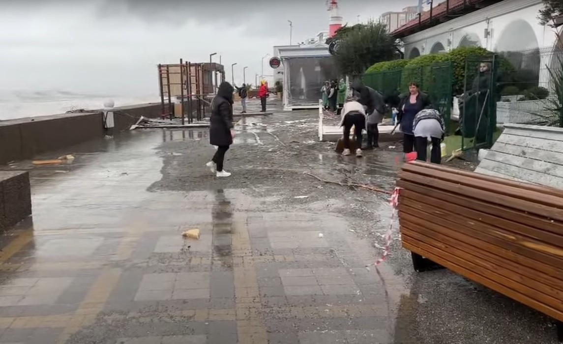
According to the weather forecaster, the hardest day in Crimea is today, November 27; Hurricane winds are expected. Tomorrow the wind speed will be 20-25 meters per second, “but it’s no longer 35-40 meters.” Precipitation in the form of heavy rain and sleet is expected, but a gradual improvement will begin. Although the alarming situation in Crimea will continue until Wednesday.
As for Moscow and the region, Roman Vilfand said that “the snow that fell will remain with us throughout the winter.” It will melt a little, but this will only cause even greater difficulties for motorists on the roads and pedestrians on the sidewalks. Therefore, “extreme care is needed.”
According to the forecaster, snowfall, although not as heavy, but still noticeable, is forecast in Moscow on Thursday. A little snow will come to the capital in early December. By Wednesday the temperature will drop: below -10 degrees at night, -5 during the day. Then on Thursday the temperature will rise to 0-2 degrees during the day and snow will fall. And on December 1, 2 and 3 the temperature will drop: about -10 at night, about -5 during the day. “Therefore, the snow will remain with us and will melt only in the spring,” summed up Roman Vilfand.
[ad_2]
Source link


