
Rosreestr seeks to record data on agricultural land in the Unified State Register of Real Estate
[ad_1]
Rosreestr has prepared a bill that, starting from 2026, will provide the Ministry of Agriculture with the authority to establish the boundaries of agricultural lands to enter information about the boundaries of such territories into the Unified State Register of Real Estate (USRN). Currently, the lack of data on the boundaries of agricultural land in the register may lead to the unreasonable classification of such lands into other categories, including inclusion within the boundaries of settlements and provision for construction. The Ministry of Agriculture supports the initiative and is working to generate up-to-date data. Experts consider the measure to be effective, although costly.
Rosreestr proposes to enter into the Unified State Register of Real Estate data on the boundaries of agricultural lands and farmland within them – a bill providing for amendments to the Land Code and the Law on State Registration of Real Estate was published by the department on regulation.gov.ru. According to the document, the Ministry of Agriculture is planned to be given the authority to establish the boundaries of such lands – from 2026, such data must be entered into the Unified State Register of Real Estate.
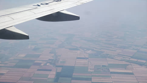
It should be noted that agricultural lands have a special legal regime – especially serious restrictions are provided regarding the turnover of farmland. According to Rosreestr, as of January 1, 2023, the area of agricultural land in the Russian Federation amounted to 379.1 million hectares, which is 0.5 million hectares less than a year earlier. As Rosreestr notes, “the trend towards a reduction in the area of agricultural land, as well as farmland within such lands,” leads to a decrease in areas with fertile soils and, as a consequence, in agricultural yields. Among the factors that lead to a decrease in agricultural land areas, Rosreestr names population growth and industrial development, which “reasonably requires an increase in the area of land of other categories.”
“In this regard, for the state, the task of obtaining information about the quantitative characteristics of agricultural lands and farmland as part of such lands, information about their boundaries is of a key nature,” the explanatory note notes. Now information about agricultural lands and agricultural lands within them is entered into the Unified Federal Information System on Agricultural Lands, but this, apparently, is not enough. Thus, the absence in the Unified State Register of Information about the boundaries of agricultural lands and lands within them may lead to their “unreasonable classification” as lands of other categories, inclusion in the boundaries of settlements, or provision to interested parties, including for construction. This, the department notes, can lead to the loss of agricultural land, including especially valuable farmland. The inclusion of data on boundaries in the Unified State Register of Real Estate, as expected, will make it possible to take into account the peculiarities of the legal regime of such lands when performing real estate transactions.
The Ministry of Agriculture told Kommersant that the implementation of the initiative will “create an effective source of up-to-date data for making decisions on the use of agricultural land.” The department calls obtaining reliable information about such lands one of its priorities – for this purpose, in 2022, the implementation of a state program for the effective involvement of agricultural lands in circulation was launched, within the framework of which a unified map-scheme of such lands is being created. Now, the Ministry of Agriculture notes, a schematic map of 36 regions has been formed – this work is planned to be completed by the end of 2025. The information received, the department explains, will become the basis for entering current data on agricultural lands into the Unified State Register of Real Estate, including data on the boundaries of farmland within them.
As Larisa Soldatova, associate professor of the Department of Public Law at the Faculty of Law of the National Research University Higher School of Economics, notes, plots of agricultural land near growing cities are of interest to developers – they are convenient for developing infrastructure and can be effectively used for locating industrial facilities. At the same time, she adds, it is very easy to use such land for construction, but returning it to a state suitable for agriculture is “expensive and time-consuming.” The expert calls the proposed initiative a measure to streamline information about lands – in general, “despite the cost, it seems effective.” For example, recalls Larisa Soldatova, similar problems have already occurred with forest lands, which were recorded separately in the state forest register, as a result of which their development was widespread and, in fact, removed from this category. The solution, she recalls, was to enter information about all forest districts and their boundaries into the Unified State Register of Real Estate.
[ad_2]
Source link


